Details
Location:
Shepreth to Fowlmere, Foxton then back to Shepreth
Weather:
Hot dry sunny day
Distance:
5.7 miles – Average speed 2.3mph
Elevation Gain/loss:
175 feet
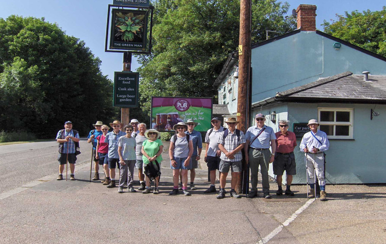
Our Group
Comprised 16 walkers led by Tony King.
The Walk
This was our 390th walk since the start of the walking group and our second visit to the Green Man
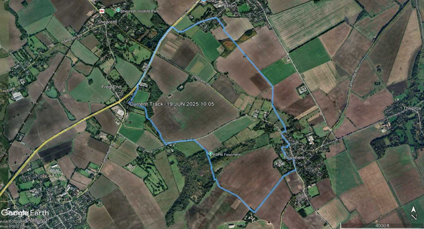
From the pub we crossed the old Dunsbridge Turnpike and walked upstream along the River Shep until we got to Fowlmere Road. We turned left onto that road and walked to the RSPB reserve at Fowlmere. From the corner of the reserve near the Spring Hide, we walked on a footpath to the edge of Fowlmere Airfield, then turned left and walked along the shaded avenue alongside Manor Farm Hill until we got to The High Street, Fowlmere, where we turned left.
We then walked along The Butts until we got to a footpath leading to Long Lane. After a short distance on Long Lane, we took to a footpath though the crop fields. This footpath took us to the southern edge of Foxton, where we walked along Shepreth Road until we got to the A10. After finding a gap in the high speed trafÏc, we managed to cross and turned towards Shepreth along the cycle track.
Just south of Dunsbridge Business Park we found another gap in the road trafÏc and recrossed the A10 onto the old turnpike road and proceeded to the Green Man for our lunch that had been ordered at the start of the walk.
The map of the walk is shown below
Fowlmere Aerodrome
Fowlmere airfield started life during WWI as an emergency landing ground. It was then used, in 1918, for training US pilots before they went to France. The airfield and its structure were completely removed by 1923.
In 1940, there was a requirement for a satellite field for RAF Duxford. After the Battle of Britain, Fowlmere became an airfield in its own right, at one time hosting 133 (Eagle) Squadron comprising entirely US volunteers.
In 1944 the airfield was turned over to the USAAF who positioned P-51 Mustangs of 339 Fighter Group there. In 1957, the airfield was relinquished back to the farmers by the RAF, one of whom, with an interest in flying decided to renovate the airfield. The main hangar is a classic T2 type (invented in 1940 by the Air Ministry in collaboration with Teesside Bridge & Engineering Ltd), but has been reskinned. There is a small museum on the airfield.
Shepreth Lakes
The southern most lake in this group of lakes is marked as a clunch pit on the 6 inch Ordnance Survey maps produced between 1888 and 1913. Clunch is a chalky limestone rock being softer than other forms of limestone.
Hauxton & Dunsbridge Turnpike
This turnpike running between Hauxton and Dunsbridge runs approximately along the line of the A10 and the trust for this was formed in 1725. The trust was also responsible for roads that currently form parts of the B1368, A10 and A1134.
Dunsbridge Business Park
Dunsbridge Business Park contains a number businesses including 1G Dynamics, which is significant to MBDA. It provides the shakers and the servicing thereof to Environmental Engineering.